What’s in an image? Sometimes quite a lot, more than meets the eye.
I’m posting an image every day (or as often as I can). It might be a photo I took, an image from Wikipedia, NASA, or some other open source, a diagram or a map. Whatever takes my fancy.
The Library at Lydiard House
This photo is a shot of the Library at Lydiard House near Swindon. The house and the park around it are owned and managed by Swindon Borough Council as a facility for local people. It’s well maintained and well used for many indoor and outdoor purposes.
The house was built in the 17th and 18th centuries by the Tregoze family. While we were looking around the house, I spotted bound copies of ‘The Works of Ruskin‘, filling several shelves.
Themed image collections
The links below will take you to the first post in each collection
If you enjoyed this or found it useful, please like, comment, and share below. (If you don’t see those links, click the article’s title above the main photo and they will appear.) Send a link to friends who might enjoy the article or benefit from it – Thanks! My material is free to reuse (see conditions), but a coffee is always welcome and encourages me to write more often!
When the canal is navigable all the way back to Saul Junction, there will be significant canal traffic and the bridges as well as the locks will need to be used fairly frequently.
In this fourth section of the canal walk, we continue along Stroudwater Navigation. Although the canal is in working condition along most of this section it is not yet connected to any other navigable waterway except for part of the Thames and Severn Canal that we’ll cover later.
This walk is 5.0 km (3.1 miles)
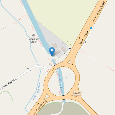
In the previous article we passed under the new Jubilee Railway Bridge and reached The Ocean. (Hint: Click the map icons for larger, draggable and scalable versions. Click the photos for full size, too.)
The map marker points to The Ocean at the end point of the previous walk. You can access the towpath from the A419 via Court Farm Mews, but if you arrive by car I suggest parking on Boakes Drive or one of the roads connected to it. You can walk past St Cyr’s church to the canal, and cross the Ocean swing bridge to reach the towpath. All of this will be clear if you expand the map.
While you’re in this area you might like to walk through the nature conservation area. There are good views of the canal from Nutshell Bridge as well, accessible by footpath from the towpath (more on that shortly) or from the churchyard. When you are ready, walk east along the towpath, leaving The Ocean behind and passing under Nutshell Bridge.
Looking back to Nutshell Bridge
There is no direct access to the bridge from the towpath, but about 60 m beyond the bridge, look for a narrow footpath leading away from the canal. If you want to access the bridge from here, take this footpath, turn right onto a similar path at the four-way crossing, then right again to cross the bridge. Retrace your steps to return to the towpath. Next you’ll pass Boakes Drive (photo below) where modern, brick-built homes have enhanced surroundings provided by the canal, you might even see boats in the canal at this point, although currently they can only travel moderate distances.
Boats on the canal at Boakes Drive
A little further on again you pass under Stonehouse Bridge with its murals. This modern bridge carries the Stonehouse to Leonard Stanley, Dursley and Nailsworth road. It was built by Gloucestershire County County in 1999.
Stonehouse to Ebley Mill
This section is 2.0 km (1.2 miles)
Ryeford Bridge and a canal workboat
After one further bridge and some woodland on the left bank, look out for ‘Skew Bridge’. This is an old iron Midland Railway bridge that crosses over the canal at an angle (hence ‘skew’). The railway was closed in 1966 and now the bridge carries a cycle route. Immediately after Skew Bridge, the A419 passes over the canal, as does Ryford Road North, this time on a fine, slightly humped, stone bridge with a brick parapet (photo above). As you continue, look for the Ryeford footbridge with white, criss-cross pattern sides, and then you’ll pass under the black gantry of a pipeline bridge.
The next point of interest is a little further on; the Ryford double-lock with three lock gates was built to allow a greater rise in a short distance. Walking on from the double lock brings you to a part of the canal undergoing dredging (at the time of writing).
Dredging is an essential form of maintenance because canals typically get shallower over time due to a build up of silt on the bottom. Dredging when necessary restores the full depth of the canal allowing deeper draught vessels to use the canal.
In the event of active dredging, signs will re-route you to the towpath further along to avoid dangerous areas and allow the work to continue uninterrupted.
Passing under Oil Mills Bridge brings you to an attractive housing development with homes and gardens along the opposite bank. After the canal was opened, industry spread to this area (Ebley) from the Stroud direction, you’ll see plenty of evidence for this. The chimney of Ebley Mills is particularly impressive, and even the newer, residential blocks echo the shapes of the warehouses of the past. This is a good place for a coffee and a snack with pleasant indoor and outdoor seating. Cross the Ebley Wharf Bridge to the little square (expand the map, the pointer marks the bridge) and you’ll find Kitsch coffee-bar (K coffee-bar on the sign). Check it out on Trip Advisor or just take my word for it.
One other feature you might wonder about is the single lock gate across the canal, but there’s no lock! It’s part of an ingenious flood-prevention measure, diverting flood water to the River Frome whenever that becomes necessary.
Ebley Mill to Stroud
This section is 1.8 km (1.1 miles)
Now for the final section of this canal walk. Continue walking east from Ebley Mill along the towpath which takes you between the canal and the River Frome. You will pass Queen Elizabeth II Playing Field on your right, quite likely you’ll see the children’s play area with its ‘canal boat’. I walked over to take a look at this, it’s evidently inspired by Stroudwater Navigation and no doubt much enjoyed by younger children.
Ella’s boat and other murals
Hilly Orchard Footbridge is another, black, girder structure on brick piers; the towpath passes underneath. This is followed by Dudbridge Road Bridge carrying the A419; as you walk underneath this large, concrete bridge you’ll see a lot of fine murals painted by local schoolchildren, many of them showing refreshing, young humour at its best. One of my favourites is ‘Ella’s Boat’ making big waves washing over the sides of a bridge. It’s hard to work out which way the boat is moving, but it’s definitely travelling much too fast for the Stroudwater Navigation!
Chestnut Lane Bridge
After the A419 bridge and its memorable artwork you will reach Dudbridge Lock and then Foundry Lock. This pair of locks needs further repair after initial restoration some time ago. Several other things are going on here, there’s a turbine generating electricity between the two locks as well as a water discharge to Ruscombe Brook and two weirs. Continuing the walk you will pass Chestnut Lane Bridge and then Lodgemore Lane Bridge, many of the opening bridges can be operated by anyone holding the correct key. With the canal in its present state the bridges rarely need to be opened, but in a few year’s time, when the canal is navigable all the way back to Saul Junction, there will be significant canal traffic and the bridges as well as the locks will need to be used fairly frequently. This will bring new challenges with water supply and traffic management.
As you return to a more industrial area, you will pass through an opening in a dressed-stone wall. As you do so, look carefully at the stonework on the left side of this entrance. The deep, horizontal grooves in the stone were caused by the rubbing of barge tow ropes over many years of use. They are a visible relic of the passing of countless barges, bargees, horses and ropes over a couple of centuries!
Thames and Severn shake hands
Just a short distance more and you will come to a monument by the towpath (open the map below, the marker points to the monument). This is the end of the Stroudwater Navigation. We are now in Stroud where coal from South Wales and the Forest of Dean would have been brought by barge from the north and west bank of the River Severn for use in Stroud’s many spinning and cloth weaving mills. Traditionally these had been water powered, but the arrival of steam power required coal, and this could be obtained more cheaply than before once the canal had been built with some of the cost savings providing profit for the canal owners and barge operators.
The Thames and Severn Canal was constructed to continue the waterway further east to make it possible to take goods from Stroud to Lechlade on the River Thames. It opened in 1789, ten years after the Stroudwater Navigation. The next part in this series will continue eastwards from the shaking hands monument as we explore the Thames and Severn Canal.
Canal walk 4 is complete, so thanks for coming along.
If you enjoyed this or found it useful, please like, comment, and share below. (If you don’t see those links, click the article’s title above the main photo and they will appear.) Send a link to friends who might enjoy the article or benefit from it – Thanks! My material is free to reuse (see conditions), but a coffee is always welcome and encourages me to write more often!
Heading further south-east from the A38 roundabout we cover the ‘Missing Mile’ and then reach a section under heavy repair, and finally a section that is actually navigable. Read about it in this third article.
In the previous article we reached the short, new section of canal inside the A38 roundabout. (Hint: Click the map icons for larger, draggable and scalable versions. Click the photos for full size, too.)
This time. we begin from the gate between the field and the centre of the roundabout; the map marker points to your initial position on the roundabout. Facing the roundabout, turn right and cross the exit and entrance of Fromebridge Mill, then follow the footpath along the right-hand carriageway of the A38. This is not a pleasant walk, but fortunately it’s not long.
Look out for the point where the road crosses the river, and 50 m beyond that you need to cross both carriageways (with great care, one carriageway at a time, the traffic can be fast). Find the footpath through the gate on the other side of the road. The map marker points to the path and the photo below will help you identify the gate you need.
Start of the path along the Frome
This footpath runs along the south-east bank of the River Frome and gradually approaches the M5 motorway which you’ll soon see and hear ahead of you. If you spot any markers for the Thames and Severn Way you can safely follow them for now.
The Stroudwater Navigation canal is filled in at this point and was some distance beyond the river but running roughly parallel. This is part of the section called the ‘Missing Mile’, the remainder of it is the other side of the M5. The river runs under the motorway, while the footpath passes through a tunnel alongside the river. Sometimes water and mud collects just inside the tunnel entrance; hopefully your footwear will be up to the task of passing this point and you’ll emerge on the eastern side of the M5.
Taking the canal under the M5
You’ve just walked beneath the M5, but how will the canal manage it? The original canal passed some distance north-east of the footpath tunnel and it would very expensive indeed to build a new route under the motorway. However, the River Frome passes under the M5 and it was decided that the best solution is to divert the canal from its old route and share the channel used by the river. A barrier will be built under the road to separate the river and canal from one another.
The Missing Mile will need to be re-dug, but along a slightly different route to take the canal from the A38 roundabout to the M5 crossing, and then joining up with the remaining canal by another new section returning to its original route again.
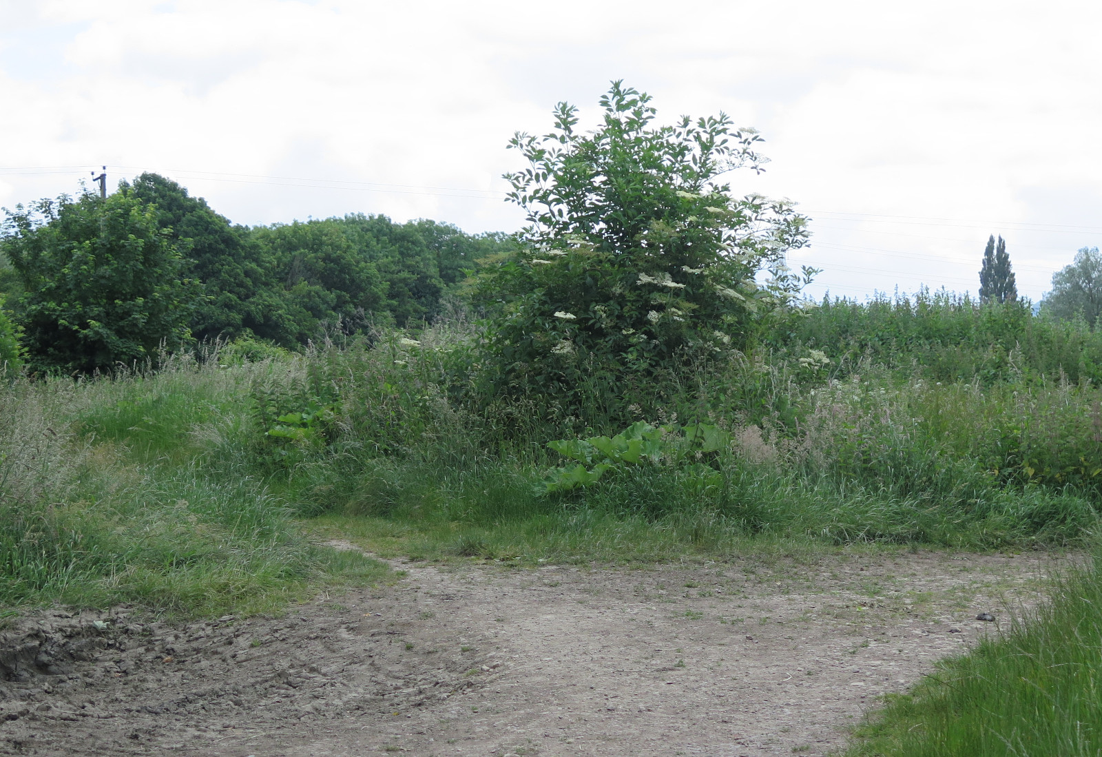
The gravelled track
Meanwhile our walk takes us along the river bank until we reach a road called Springhill in the village of Churchend. Turn left on to the road and in a short distance, take the gravelled track on the left (see photo).
At the far end of the short track you will come out near to a brick bridge. This is Westfield Bridge, part of the original canal and it marks the other end of the missing mile.
The map marker is centred on the middle of the bridge. Standing on the bridge and looking left you will see the course of the new section and work ongoing in preparation for excavating the channel. Looking right you will will see restoration under way on the original canal as it continues eastwards. The brickwork for Westfield Lock (aka John Robinson Lock) is under reconstruction right by the bridge (photo below). The Missing Mile is all behind you now!
Westfield Lock
At the bridge, look for any temporary signs for the towpath (a public footpath at this point). The path might be before or after crossing the bridge; if possible, you need to turn right (east) from the bridge along the canal. Note: if the footpath is closed because of the ongoing work, the alternative is to return down the track back to the road and turn left up the hill to Pike Bridge. But assuming the footpath is open, along the way you’ll see a lot of work ongoing to restore the old canal to a working state. Several locks are being actively worked on. The footpath takes you up to Pike Bride where you can look back to get an excellent view of the ongoing work. Cross the bridge and you’ll see the continuing canal in water and in good condition.
Onward to The Ocean
Follow the towpath east from Pike Bridge, after passing Pike Lock on your right, the first thing to note is the riveted, iron narrowboat ‘Leviathan’, used until the 1990s as a workboat by restoration volunteers. Another 150 m brings you to Blunder Lock, very close to the A419 road and the second in a ladder of locks – Pike, Blunder and Newtown. Blunder Lock probably got its name because it was dug to the wrong depth by the engineer, despite clear and detailed instructions.
Bond’s Mill
Another 90 m brings us to Newtown Lock and we start to get away from the A419; the tow path takes us through an idyllic, wooded area with a peaceful canal full of water as it would have been as a working waterway. Bond’s Mill is the next landmark and the unusual two-storey World War II pillbox is notable. It’s worth stopping for a while if you have time. Sometimes the pill box is open, but if not there are useful information boards on the outside.
Ocean Jubillee Bridge
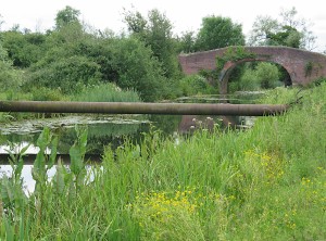
Soon after Bond’s Mill comes a major achievement, the Ocean Jubilee Bridge. The canal was here before the railway, of course, and when the railway was built, they simply constructed a bridge to cross the canal, just as they would to cross a river or a road. The canal went out of use, largely due to competition from the much faster and more efficient railways; over time the bridge needed replacement. When the time came to do this, the railway engineers decided that a culvert would suffice, with the embankment extended over it. This left the disused canal in a state where it could not be restored without building a new bridge. Network Rail engineers did exactly that, and the result is what you see today.
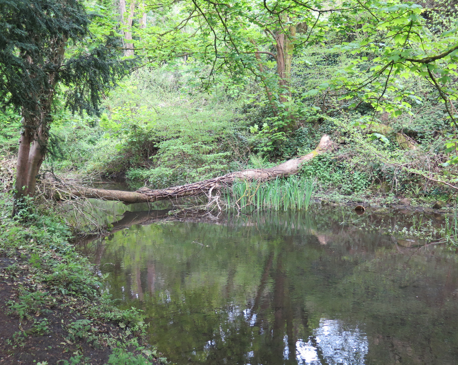
And, finally for this part of our canal journey, walk under the bridge and take a look at the widening of the canal at this point. This body of water, a haven for wildlife of all kinds, has been known for a very long time as ‘The Ocean’. Nobody knows for sure how or why it acquired that name, but it might have been the largest body of open water known to the local people.
That’s it for Canal walk 3, thanks for travelling with me.
If you enjoyed this or found it useful, please like, comment, and share below. (If you don’t see those links, click the article’s title above the main photo and they will appear.) Send a link to friends who might enjoy the article or benefit from it – Thanks! My material is free to reuse (see conditions), but a coffee is always welcome and encourages me to write more often!
Heading further south-east from Saul Junction there are several little pieces in good shape, and a lot of repair work ongoing. You can read all about that work right here in this second article.
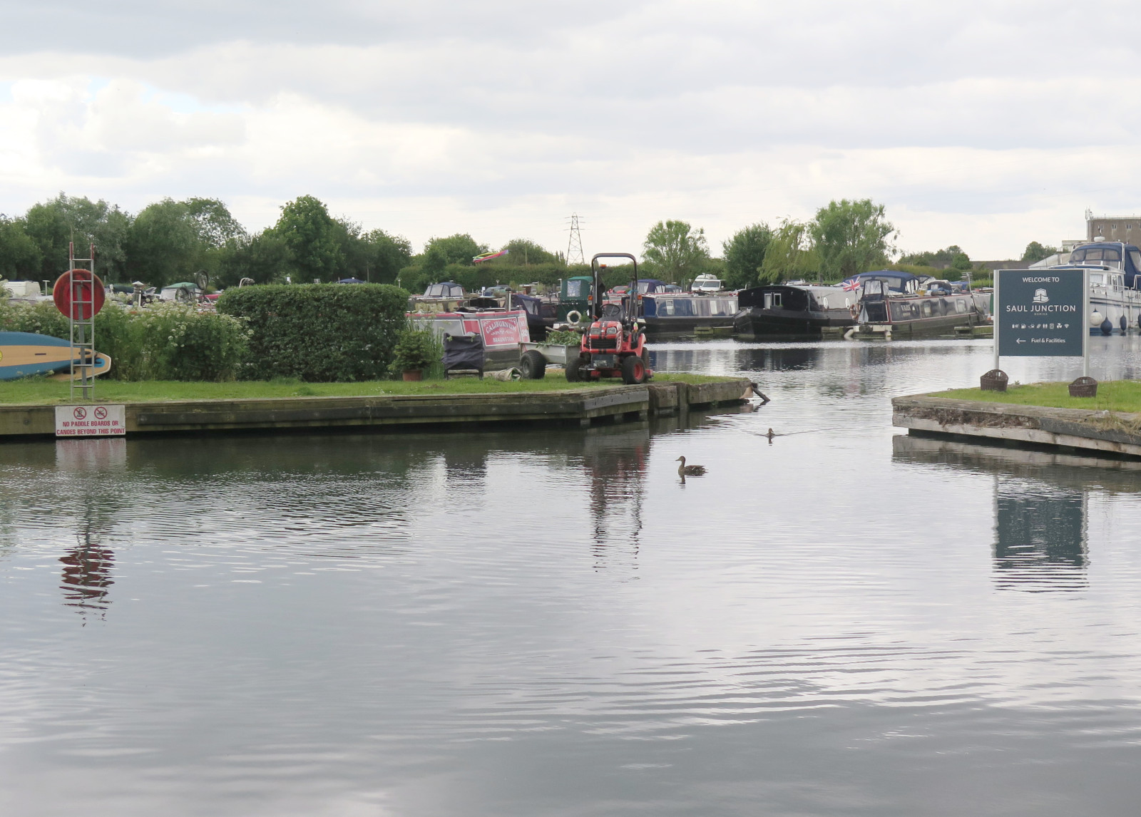
Saul Junction
Saul Junction Marina
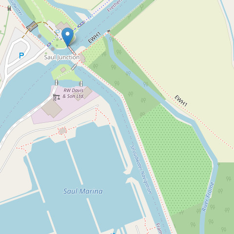
As mentioned in the previous article, the Stroudwater Navigation continues straight across the much larger Gloucester and Sharpness Canal. Looking south-east across the ship canal you can clearly see Stroudwater Navigation continuing, not only full of water, but still in use. We’ll cross the footbridge and follow it from that point. (Hint: Click the map icons for larger, draggable and scalable versions. Click the photos for full size, too.)
Walking south-east across the footbridge (see pointer on map) there is a right-hand bend and then an opening from the canal to a thriving marina.
The canal itself is very wide at this point and there are many moored boats alongside the towpath, The photo shows the widened Stroudwater Navigation in the foreground and the marina entrance. From here, the towpath continues to Walk Bridge.
Originally built as a swing bridge, Walk Bridge was replaced by a concrete and brick constuction, so a new opening bridge must be constructed to replace it. Cross the road and it’s clear that the canal is still in water at this point, but there’s no towpath. Enter the field by the stile, turn left, and walk diagonally across the field to the far side leaving the canal behind and to your right.
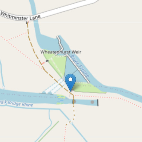
This brings us to Whitminster Bridge and Lock where there’s another glimpse of the canal’s remains. The photo below shows the point marked on the map. Turning a couple of metres right along the farm track will give you a view of the old canal lock. There was another swing bridge at this point.
Easy to go wrong here!
The small footpath to the left in the photo is part of the towpath and this is the route to take next. As you follow this path you’ll see the River Frome on your left. The canal has been filled in and would have been on the right.
The path and the river both bend to the right and then the path enters a strip of woodland along the river bank.
Through the wood
The path is poor, with large potholes filled with mud after prolonged rain. Care is needed and there are many roots that form real trip hazards, but the woodland doesn’t continue for very long (250 m or so) so slow and careful won’t reduce progress very much overall.
Once again, the river and footpath bend to the right, look for a concrete farm bridge (photo) across the river and take it, you’ll soon have the canal on your right. There was an aqueduct close to this point where the canal crossed over the river, but it no longer exists and the canal has been filled in for a short distance.
The map marker points to the bridge mentioned above; if you expand the map you can see the end of the woodland at top left and the canal section in water as well as the filled in part.
That looks more like a canal now!
The next major feature is a crossroads of tracks and footpaths, there’s a post here with a blue Cotswold Canals sign which you should follow. The canal is in water again at this point, stand on the track where it crosses the canal and you can see it for a long way in both directions. you’ll also have a clear view of the canal as you continue along the towpath (photo). At the time of writing dredging work is underway on some days. If you’re unlucky parts of the towpath will be closed and you’ll be redirected. But most likely it will be open (and is always open at weekends and on summer evenings).
On to the bridge and pillbox
The final section of this walk is quite straightforward – just keep following the towpath. There are some interesting things along the way though, and an unexpected treat at the end as well. On your way you may see evidence of the dredging work still active along this section.
When you come to a stile, cross it into the next field and continue on the towpath. A little further and you’ll notice a large pipe acros the canal and just beyond it a brick-built bridge, this is ‘Occupation Bridge’. The pipeline was constructed during World War II, part of a network to carry aviation fuel for the RAF. It is still in use and will need to be diverted beneath the canal.
Beyond the bridge you’ll find a pillbox (also WW II) near the right bank of the waterway, and shortly afterwards you’ll arrive at the destination for this article, the A38 roundabout. Here comes the unexpected treat I mentioned earlier. Make your way through the galvanised steel gate and turn left, a short downhill scramble. Here you can pick up the towpath again and explore a newly built section of canal crossing the centre of the roundabout. So astonishing to see a newly built canal in the middle of a major intersection!
The canal here was built by National Highways who also constructed the roundabout. When you reach the far side you’ll see that the canal currently ends at this point. The ‘Missing Mile’ begins here and we’ll explore it in the next article, ‘Canal Walk 3’.
If you enjoyed this or found it useful, please like, comment, and share below. (If you don’t see those links, click the article’s title above the main photo and they will appear.) Send a link to friends who might enjoy the article or benefit from it – Thanks! My material is free to reuse (see conditions), but a coffee is always welcome and encourages me to write more often!
This section of Stroudwater Navigation is not being restored, but it is certainly of historical interest and mostly remains visible on the ground. It’s still possible to walk almost all of the towpath and not too hard to imagine what it might have been like when it was in use.
The connection to the River Severn
The River Severn at Framilode (near high tide)
The physical point where the canal joined the Severn is not accessible as it’s on private land. However, it’s easy to get very close. The River Severn is still tidal at this point, and the canal engineers had to take this into account. Instead of a single lock gate providing access, there were several; this allowed boats to transfer between river and canal for longer periods as the tide ebbed and flowed.
To find this spot on the ground, visit the village of Upper Framilode and look for the point near Lock House where the road crosses the line of the canal, then click the tiny map on the right for a larger, draggable and scalable version. The pointer shows where the canal and river meet, the place where Severn trows and other boats would have entered the canal heading towards Stroud, or exited into the Severn to make their way north towards Gloucester, Hereford and Worcester, or south towards Bristol and the River Wye to Chepstow and Monmouth. If you have time, pop into St Peter’s church in the village and enjoy the simple stained glass and the beautifully painted ceiling. A peaceful place, used by the local community in many interesting ways.
Severn trows were flat-bottomed, single masted sailing vessels, and Stroudwater Navigation was wide and deep enough to take them, with locks sized accordingly.
You can also view a map of the canal from the 1840s to compare with the current map. This, too, is draggable and scalable. If you open two browser windows side-by-side with the modern map in one and the historical map in the other, it’s fascinating to see the many changes that have taken place.
To start the walk south from Upper Framilode, look for the footpath just left of the canal as seen from Canal Row. This is the old towpath and runs between the canal and the row of buildings that grew up along the first 100 m of the canal. Presumably most, if not all, of these buildings sold necessities to the passing canal traffic. I can imagine everything from ale to fresh well water and hens eggs and other garden produce being traded while boats loaded and unloaded or just waited for a lock to fill or empty.
Heading south
View back to Canal Row – from left are the canal, grassy towpath, and row of buildings
The first landmark you will come across is ‘The Ship’ inn. You’ll pass the pub and then its car park, both on the left. After passing it, looking back you’ll see its name painted on the building’s wall. It’s only 250 m or so from the start of the walk.
It’s not hard to imagine the trows travelling to and fro along this section of the canal. No doubt the pub was a popular stop.
The Ship Inn, looking back towards the start
As you can see, this first section of canal is still in water, and along the way you will have noticed the large stones edging the canal. Lock gates and other wooden structures have long since gone, of course, rotted away by the action of rain, fungi and bacteria. Like all human technology, canals must be maintained if they are to continue working. Although there’s still water at this point the canal is certain to be heavily sited up, and reeds, rushes and other water-tolerant and water-dependent plants have colonised very effectively.
The map marks the next point on the journey, the place where Moor Street crosses the canal over Saul Bridge. It’s the first bridge you come to and is not far beyond The Ship Inn. Originally this was a swing bridge, but the modern replacement is concrete and brick. Continue along the towpath beyond the bridge and you quickly come to the end of the section of canal remaining in water. The scene changes quite a bit from here on.
The River Frome comes alongside the tow path on the left at a point where the canal (still on the right) becomes dry; you can see this point on the map in the previous section. Don’t be confused! For a while you will see the Frome on the left of the tow path and the dry canal on the right. In places the canal has been filled in and that makes things even more difficult to visualise. Sometimes you can spot the left bank of the canal as a curved ridge, even when it runs through an open, grassy field. The towpath would probably have run along the flat top of this ridge.
River, footpath, and the bank of the canal
Just keep walking on the footpath and you’ll be OK. If you see signs for the Thames and Severn Way, Cotswold Canals Trust, or Saul Junction follow them; they will all guide you along this section of the canal. After the section of infilled canal, there’s a very overgrown part, and finally the footpath opens onto Saul Junction itself.
Here, the Stroudwater Navigation (opened in 1779) continues straight across the much larger Gloucester and Sharpness Canal, which opened in 1827, carries much larger vessels, and connects Gloucester Docks with Sharpness. At Sharpness, vessels can continue on the river to and beyond Bristol. Look across the ship canal where you will see Stroudwater Navigation continuing, not only full of water, but still in use. I’ll write about that next section in a future article.
Once the ship canal was open, it made a much better, non-tidal route to Gloucester or Bristol, and that’s why this section of the Stroudwater Navigation languished and fell out of use. The crews of trows coming and going to Stroud simply had no reason to enter the Severn from Saul Junction after 1827.
*This is a great source of canal images, history and all sorts of detail. Highly recommended and well worth exploring!
Useful? Interesting?
If you enjoyed this or found it useful, please like, comment, and share below. (If you don’t see those links, click the article’s title above the main photo and they will appear.) Send a link to friends who might enjoy the article or benefit from it – Thanks! My material is free to reuse (see conditions), but a coffee is always welcome and encourages me to write more often!
I set out for a walk along the canal, not intending anything more than a quick explore. I began near Chalford and thought of walking in the Stroud direction, but on the spur of the moment I decided to follow the canal through Chalford village instead as I hadn’t gone that way before.
This is a typical view of the canal in this section
A gentle stroll turns into a major plan
I was enjoying my walk and soon decided to extend it as far as the mouth of the canal tunnel at Daneway Inn. While driving home afterwards I had the idea of walking the entire route in small chunks. So I now have a plan for the old Thames and Severn canal; I’ve done several sections previously, but this time I hope to repeat the walks, covering as much as possible in short sections, and writing up each walk for Journeys of Heart and Mind (JHM).
Part of the canal runs through a tunnel with several sections blocked by collapses, some other sections run through private property and can’t be accessed. Others have been filled in, turned into roads, or are otherwise not walkable. But where the canal has been restored, the towpaths are in great condition. Elsewhere, towpaths are usually passable, especially in dry weather, and they are usually open for use even when the canal itself remains derelict.
Making a start
I was able to park the car right by the tow path (Map), just off London Road west of Chalford (very near Belvedere Mews). Don’t assume you’ll be able to do the same; you might, but there’s only room for half a dozen cars here.
The canal is quite derelict in this section, there’s water in it at many points, but not everywhere. The stonework and brickwork of the locks is severely damaged, and more recent structures such as pipes and small bridges cross the canal and will need to be rerouted or rebuilt. In places the canal has been filled in and one section has been used as a diversion and is now part of the River Frome. The eastern part of today’s route will be very expensive to restore; there are, for example, sixteen locks to rebuild, and not just a simple refurbishment of the masonry and new, timber, lock gates. For the most part it will be a combination of restoration and refacing where possible, but full reconstruction from scratch in many places where the damage is particularly severe.
It’s hard to grasp how destructive the natural world is to our built environment. The canal was dug 235 years ago (completed in 1789) and during its period of use must have been well maintained and repaired whenever necessary. The last narrow boat traffic passed this way about 100 years ago. It was already in bad shape by then, but natural decay, leaks and the growth of trees has resulted in the dereliction we see today.
Section by section
Leaving the car, and carrying my rucksack with a water bottle, I headed east along the tow path. I didn’t take a map, but the path is well marked. I subscribe to the OS maps on my phone (good enough for walks like this) and next time I plan to use the OS 6-inch map for 1892 to 1914 to better understand the canal’s surroundings while it was still in use.
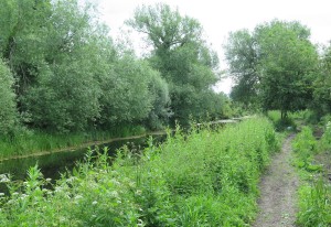
The River Frome in Chalford
(Hint: Click any image to enlarge it.)
The section through Chalford village is very pretty, on the information boards it’s likened to a Swiss valley. That’s a fair comparison, I think. The wooded valley rises sharply on either side, the River Frome (or Stroudwater) runs along the valley bottom, and stone cottages cling to the slopes on either side. If you could only visit one place along the canal, Chalford would be an excellent choice.
Swan’s nest
Beyond the eastern end of Chalford, the tow path passes a lake on the left; originally this was a mill pond, supplying water to turn the wheel at Baker’s Mill. When the canal was constructed, water supply was a frequent problem and the mill pond was extended by the canal engineers to keep this section of the canal full enough even when the locks were operating frequently due to higher traffic levels. The lake is partly silted up now, especially close to the mill, and it has become a wildlife reserve. Passing this point I spotted a swan’s nest in use and a group of mallards nearby.
Marsh marigold in the canal
Some sections of the canal are badly silted and are full of plants like this glorious marsh marigold close to Siccaridge Wood. The nature reserve is well worth a visit if you have time. The site stretches up the hill from the canal and faces south, so it’s a warm spot when the sun shines and likely avoids early frosts in autumn and late ones in the spring. Further on again, a small footbridge crosses the canal and the tow path continues on the north bank until it reaches Daneway Lane.
I stopped at the Daneway Inn for a lovely Coronation Chicken sandwich with a simple salad and some crisps along with a welcome cup of coffee. I have to report that service was prompt and I felt welcomed. The canal continues a little further and the path resumes from the corner of the Inn car park. The tunnel portal (Map) looks mysterious and, frankly, uninviting. It would have been an adventure to travel through the tunnel in a narrow boat; one day it may be possible again!
If you enjoyed this or found it useful, please like, comment, and share below. (If you don’t see those links, click the article’s title above the main photo and they will appear.) Send a link to friends who might enjoy the article or benefit from it – Thanks! My material is free to reuse (see conditions), but a coffee is always welcome and encourages me to write more often!
The museum hosts meetings with visiting speakers on a wide range of topics and runs town walks focusing on specific time periods.
If you are even slightly interested in the history (and prehistory) of Cirencester, here are some resources you might like to know about. Some are really obvious, others a bit more obscure, but they are all useful. There will be more that I’m not aware of.
The Civic Society has erected blue and purple plaques around the town. The blue plaques provide details of well-known people and events. The purple plaques mark places of significance in Roman times, the city gates for example. The website offers a map of the plaque positions and a walking route to view them all.
The most obvious and outstanding of these resources is, of course, the Corinium Museum. In its original form, on Tetbury Road, it was mostly a collection of Roman artefacts. But today, in its current home on Park Street, it covers an enormous time span, from prehistoric times, practically up to the present day. This museum punches way above its weight for a town the size of Cirencester.
The museum hosts meetings with visiting speakers on a wide range of topics and runs town walks focusing on specific time periods. There’s plenty to see and do, and if this was the only resource in existence you could still learn a great deal about Cirencester’s past.
Holds a large collection of relevant documents. Viewing them will involve making an appointment and a trip to Gloucester where they are held in the Gloucestershire Archives by the county council.
Institute of Historical Research
The institute’s material on Cirencester includes drafts of publications covering several periods of the town’s history. These drafts go into considerable detail and are written by qualified experts. They’re well worth a read, you certainly wouldn’t be wasting your time if you want more background on the town.
National Library of Scotland
Despite the name, this organisation holds many historical maps covering the whole of the UK. The website provides very useful access to the maps, you may find this search for material on Cirencester helpful. The map at the top of this article shows details even inside the Parish Church, and buildings in the West Market Place that were demolished many years ago.
Wikipedia
Wikipedia has short articles on Cirencester and Corinium. Both form good introductions to the history of the town and provide useful references.
And finally…
Leave a comment with details of anything you think I should add, I’ll check out suggestions and update this article accordingly. Thanks!
I’ll just mention in passing that I’ve been posting monthly notes on my own, personal history. My friends and family enjoy reading it, but it’s not private. If you feel inclined, take a look at the index. Cirencester gets a mention here and there as I lived in the town as a child and came back in retirement.
Useful? Interesting?
If you enjoyed this or found it useful, please like, comment, and share below. (If you don’t see those links, click the article’s title above the main photo and they will appear.) Send a link to friends who might enjoy the article or benefit from it – Thanks! My material is free to reuse (see conditions), but a coffee is always welcome and encourages me to write more often!
There is cause for concern, but there is also cause for hope.
The war in Ukraine (and increasingly in Russia now as well) is on everyone’s minds – or certainly should be.
Part of an image from ISW
Below, I present a quote from today’s ISW report on the Russian attempt to conquer Ukraine. ISW is the ‘Institute for the Study of War’, an independent and influential American think-tank reporting every day as events unfold. But today they began their report with an overall assessment following two years of the war. Here’s the extract, with links to today’s full article and more at the bottom. There is cause for concern, but there is also cause for hope.
Ukraine continues to defend against Russian aggression and the Kremlin’s attempt to destroy Ukrainian statehood and identity despite growing difficulties two years after the start of Russia’s full-scale invasion. Two years ago Russia launched a full-scale war of conquest to overthrow the Ukrainian government and forcibly install a pro-Russian regime firmly under Moscow’s control. Russian forces drove on Kyiv from several directions and struck at Kharkiv, Kherson, Mariupol, and other Ukrainian cities. Russian President Vladimir Putin expected Ukrainians to welcome his forces or flee. Instead, Ukrainians fought for their freedom. They stopped the Russian drives on Kyiv and Kharkiv cities, stopped the Russian advance on Mykolayiv and Odesa cities, and fought Putin’s troops to a standstill along the rest of the line. Then, armed with experience, courage, determination, and growing Western aid, Ukraine struck back. Ukrainian forces drove the Russians from Kyiv and away from Kharkiv and liberated large swathes of territory in northeastern Ukraine. They liberated Kherson City and forced Russian forces off the west (right) bank of the Dnipro River. They ended the threat to Ukraine’s existence for the time.
But the Russians did not abandon their war aims or slacken their military operations. They remained in control of areas strategically and economically vital to Ukraine’s survival and of millions of Ukrainians whom they are subjecting to brutal Russification campaigns and deportation schemes. The Russians launched a missile and drone campaign against Ukraine’s energy infrastructure and cities that continues to this day. The Russians then ground through the eastern city of Bakhmut, taking losses so devastating that they prompted an armed rebellion against Moscow. The Russians also prepared themselves for the expected Ukrainian 2023 counteroffensive. The excessive hopes for that counteroffensive were not met. The war assumed a positional character, and the expected US assistance has been held up.
The situation today is grave, but it is far from hopeless. Russian forces have regained the initiative across the theater and are attacking and making gains. Those gains thus far are very limited and extremely costly. More Russian soldiers have likely died to seize Avdiivka than died in the entire Soviet-Afghan war. Ukrainians are weary and worried that American military assistance will cease, but they continue to fight with determination, ingenuity, and skill. Ukraine’s air defenders are dropping Russian planes from the sky while Ukrainian drone-and missile operators sink Russian ships. And Ukrainian soldiers are fighting for their positions against Russian “meat assaults” using drones in novel ways as well as the artillery, tanks, and traditional weapons of war available to them. The Ukrainian Air Force will receive its first F-16s in the coming months, and Ukraine’s European allies are racing to make good deficiencies in other war materiel. American military assistance remains essential—only the United States has the resources to give Ukraine right now what Ukraine most needs. If the United States, in the end, withholds that aid, then the situation can become very grave indeed.
But the war is far from over. Ukraine has not lost and there is no reason for Ukraine to lose. Russians are adapting for a long war effort in Ukraine, but they are not the Red Army hordes wrapped in the triumphant banners of World War II victories that Putin and his propagandists pretend them to be. The Russian military suffers from many flaws that Ukraine has learned to exploit. And the combined economic power of Ukraine’s allies is many times that of Russia.
Putin remains a deadly threat to NATO as well as to Ukraine, however. The Kremlin has been setting conditions to conduct hybrid warfare operations in the Baltic States and Finland for months and is currently engaged in such operations against Moldova. Putin’s aims remain the destruction of NATO as an effective alliance, the breaking of the tie between the United States and Europe, and the construction of a new global order in which Russia’s voice and power are dominant. The interests of America, Europe, and America’s allies in Asia and around the world are inextricably tied with helping Ukraine defeat Russia.
I hope those words from ISW encourage you, they certainly should. Ukraine had done astonishingly well in this horrible war so far, and will continue to do well providing she continues to receive sufficient help from her allies.
Tomorrow I plan to post again, this time with some of my own thoughts about the state of affairs in the war and the likely outcome. Meanwhile, here are some links to ISW and relevant pages.
Institute for the Study of War (ISW) – Web homepage
We enjoyed every aspect of the house … and we plan to return in the summer to view the garden as well.
We visited Chastleton House recently, it’s a Jacobean country house in the Cotswolds, between Stow-on-the-Wold and Chipping Norton. Amongst other features it has the wonderful Long Gallery with a curved, plasterwork ceiling and panelled walls. Amazing!
The Long Gallery on the top floor
The house is in the care of the National Trust and was open to the public for the period leading up to Christmas. They’d decked it out with Christmas decorations as they might have been in the 1960’s – wrapped gifts, paper chain decorations, Christmas tree lights of the period, everything.
1960s decorations
But the real gem, and what I especially wanted to see, was the Long Gallery. It was certainly not a disappointment!
We enjoyed every aspect of the house, of course, and we plan to return in the summer to view the garden as well. Living, as we do, in Cirencester it’s not a long journey so we can also visit in spring and autumn too if we wish.
I can recommend a visit to Chastleton. It’s a gem of a place.
Notes from bygone years – December after December, Christmas after Christmas… Hint: Click on the thumbnails for larger images.
December 2022 (1 year before publishing this article)
A fine stack of cats
In December 2022 I posted my first attempt at ‘Blast from the past’. It was brief, covering just 1, 2, 5, 10 and 20 years; I only mentioned earlier JHM blog posts, nothing about my personal history or memories, and no images. It’s changed beyond recognition in 12 months!
On 17th December we drove up to York to visit my daughters and our grandchildren. On the way, the snowy fields and trees were really lovely to see. On the 18th we walked into the centre of York together and looked around Fairfax House, a fabulous and fascinating place – well worth a visit if you’re in York and haven’t seen it before. On 19th, back at home, I built a stack of cats! These were a present, a game where players take turns to add one cat – until the stack collapses.
Also in December 2022, I published an article about order and disorder, destruction and abundance, restrictions and freedom. I called it My Father is a farmer.
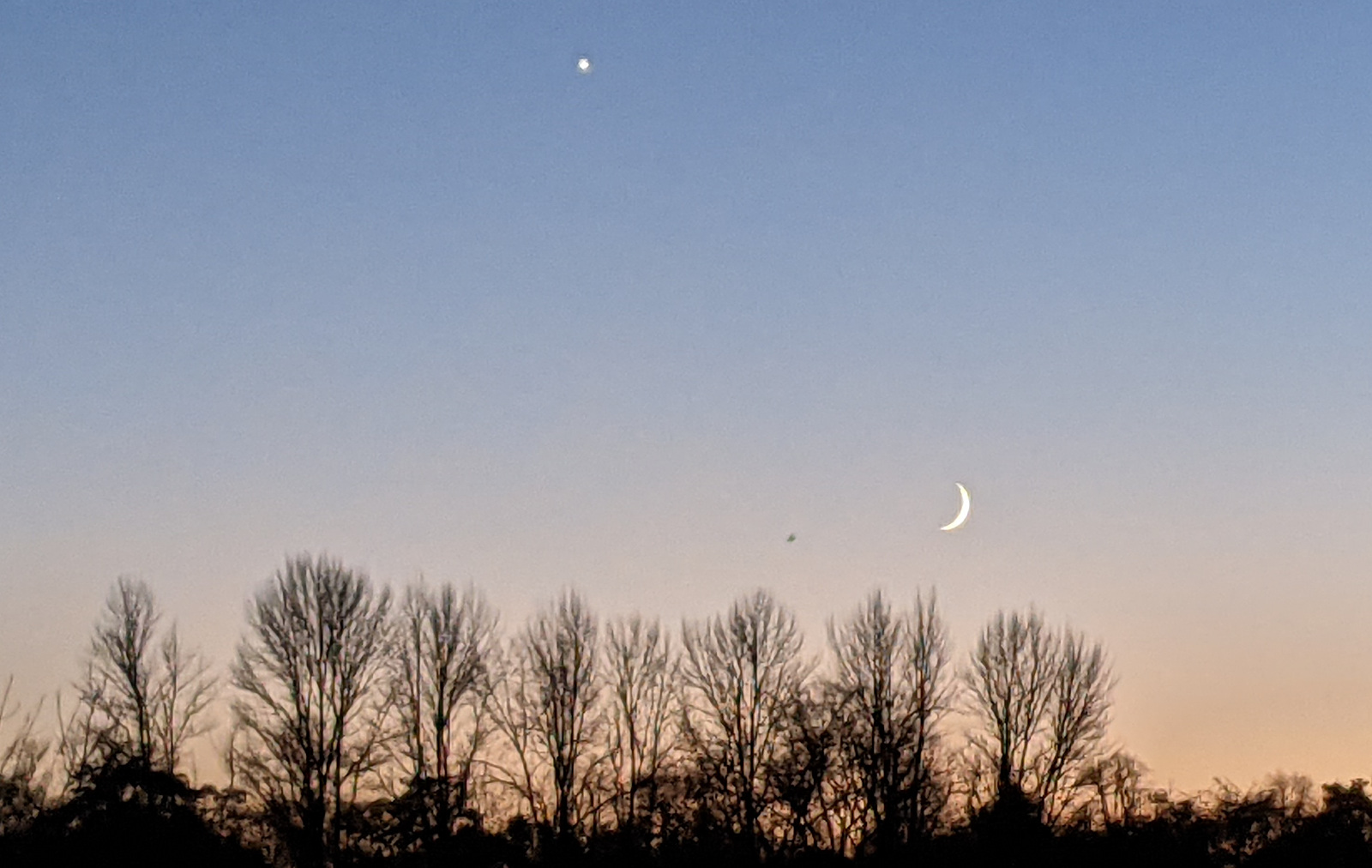
In December 2021 the young Moon and Venus made for a lovely sky in the evening twilight. I took this photo, only noticing later that a passing bird had photobombed the scene!
My friend, Nick Henderson invited me to write an article on why I left the Anglican church. You can read it here on my blog, and and on his website, Anglicanism.org.
In December 2018 I took a photo of the clock on Cirencester’s Parish Church tower. The honey coloured Cotswold limestone of the tower glows gloriously in the orange light of the setting sun. What a combination! Studying the photo later, I realised for the first time that the clock face is painted onto the stone of the tower. I had always imagined it was a large wooden or metal panel.
I posted an online card for Christmas and New Year, hoar frost on red berries.
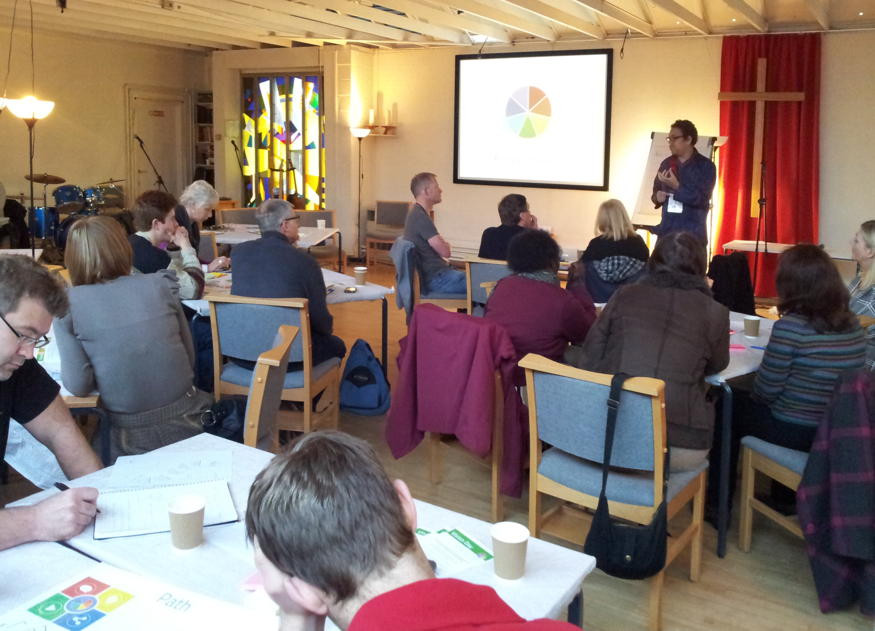
In December 2013 I was at a Newforms Gathering in Nottingham. It was great to be amongst other people doing their best to follow Jesus and represent him in what is often a very broken world.
On JHM I wrote about food banks and why they were needed in Britain. Sadly they are still needed a decade later.
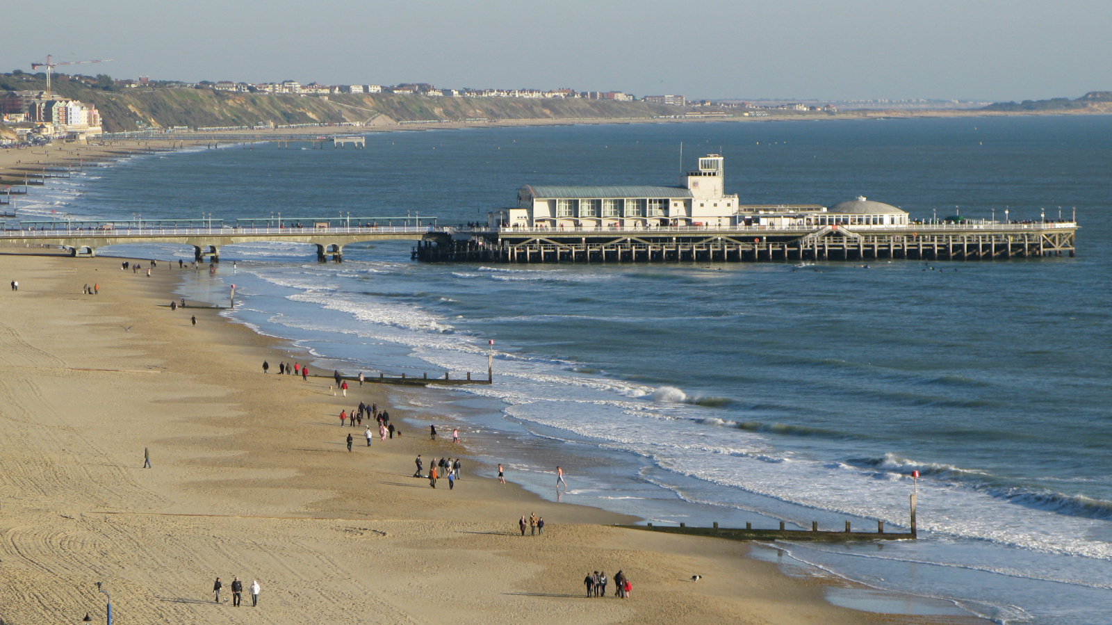
In December 2008 we visited Donna’s parents and walked along the coast near Bournemouth. It looked lovely with some strong sunshine, but my word it was cold!
I wrote an article on JHM the same month on the topics of science and technology.
In December 2003 I was working for Unilever Research; and the department had a couple of working away days as a planning and learning exercise. These were always daytime effort and evening fun.
In December 1998 we were living in Tilbrook, a tiny village near Kimbolton, Bedfordshire. I received my replacement driving licence for the new address. There was no plastic card, this document folded up and fitted into a flexible plastic sleeve.
In December 1993 we were living in Yatton and visited Judy’s parents in Cheltenham for Christmas and my parents in Cirencester for New Year. Here are Cindy, Rachael, Neil and Tom in the dining room at Churnside, playing Buccaneer. It’s a 1938 game of pirates, treasure, shipwreck and rum – great fun.
In December 1988 we visited my parents in Cirencester. Dad still had his African land snail in the glass tank and everyone was interested to take a closer look at it. Beth is unfortunately hidden behind Debbie in this shot. The glass tank was originally for a lead-acid radio battery.
In December 1983, my department at Long Ashton was beginning the process of working out how proposed budget cuts would effect staff. Some would be redeployed in other research centres. Others would be made redundant.
In December 1978 Debbie was three and three quarters and Beth was 7 months old. We’d been in our 1960s mid-terrace house in Yatton for some time but there still seemed to be enough room for us. In Iran, two million people demonstrated in the streets against the Shah.
In December 1973, we were trying to save enough money for a deposit on a mortgage. We’d saved quite a lot, but house prices were rising faster than we could manage.
The Pioneer 10 spacecraft was the first probe to fly past Jupiter. The images were fuzzy by modern standards, but far better than any telescope could achieve at the time. I remember sitting in the library at work in my lunch break, reading about it in Science, Nature, and at home in New Scientist.
December 1968 was a significant month. As far as I can recall, on 31st December both families were in the same room in Cheltenham when I asked Judy’s Dad if I might marry his daughter. He said, ‘Yes’, right away so all was well. It’s possible this was very early January, but I think it was New Year’s Eve. Of course, Judy and I had decided this well in advance but it was fun to make the move with everyone present!
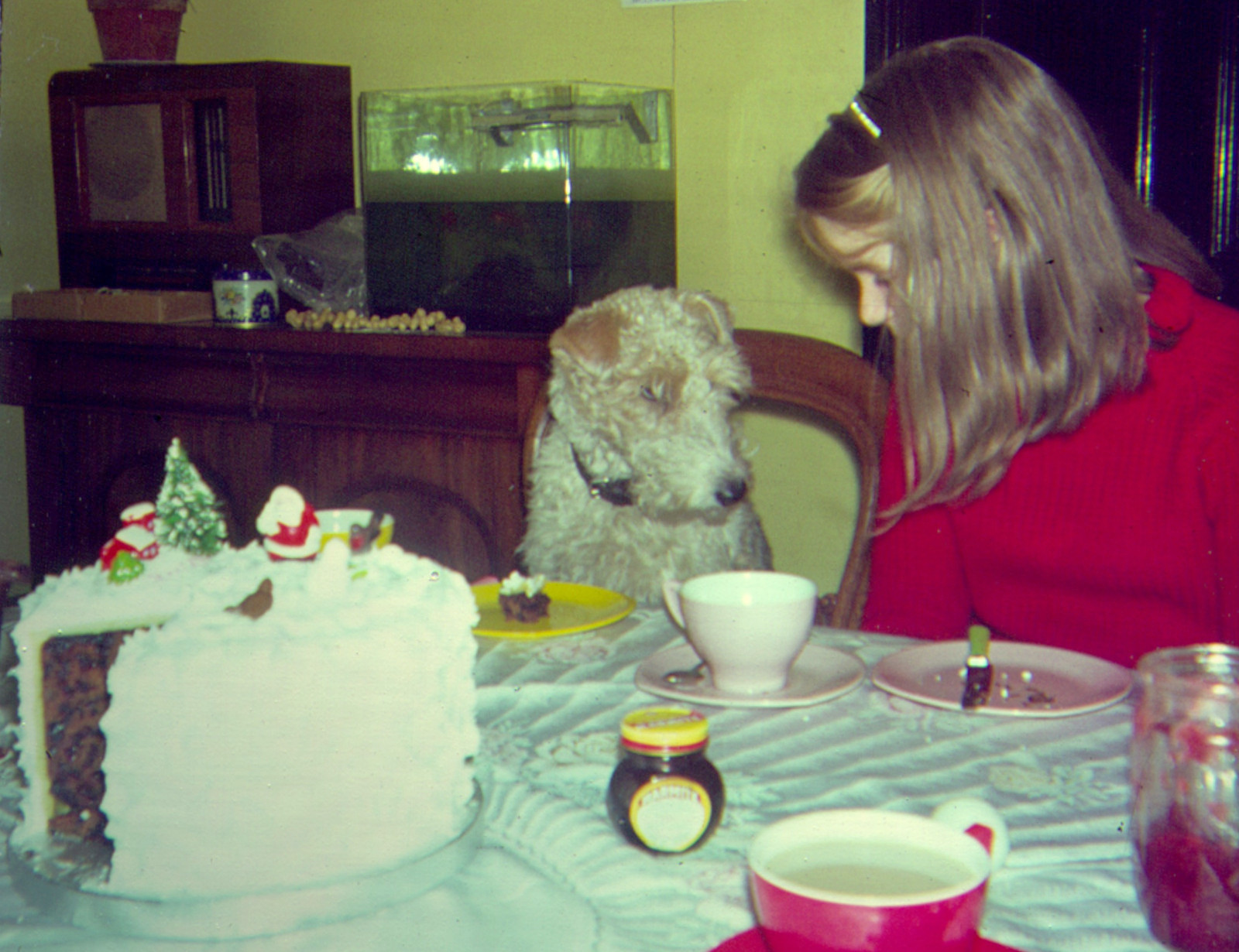
In December 1963 I was in the Fifth Form at Cirencester Grammar School. Mum made the usual stonkingly large Christmas cake (we always managed to eat it all in a week or so). Even Chloe, the dog has a small slice on her own plate in the photo. And, of course, it goes without saying that there’s Marmite on the table.
In December 1958 I was in my 6th and final year at Querns School. One of my friends from before we started school, Robert Kneale, wrote a Christmas poem for our teacher, Miss Taylor. We were both ten at the time, I wonder if he had a little help from his Dad, George? It’s a great effort – click on the image to read it.
At the end of December 1948 I was five months old and turned over by myself for the first time on 2nd. Dad had a 10/- raise in his wages and was busy lifting Christmas trees for sale.
In December 1943 Dad travelled by train to Paddington Station and on to Euston House where he went through a series of subject exams and aptitude tests. He was enlisted as a Radar Operator in the RAF Volunteer Reserve, received 10/6d pay, and was deferred for six months. He was very disappointed to have been turned down as a pilot.


