Canal walk 2 – Saul Junction to the A38

There was an aqueduct close to this point where the canal crossed over the river

< Previous | Index | Next >

Heading further south-east from Saul Junction there are several little pieces in good shape, and a lot of repair work ongoing. You can read all about that work right here in this second article.

Saul Junction
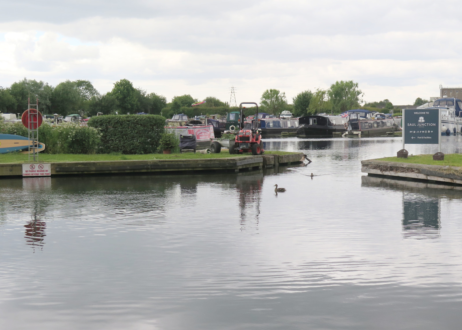
Saul Junction Marina

As mentioned in the previous article, the Stroudwater Navigation continues straight across the much larger Gloucester and Sharpness Canal. Looking south-east across the ship canal you can clearly see Stroudwater Navigation continuing, not only full of water, but still in use. We’ll cross the footbridge and follow it from that point. (Hint: Click the map icons for larger, draggable and scalable versions. Click the photos for full size, too.)
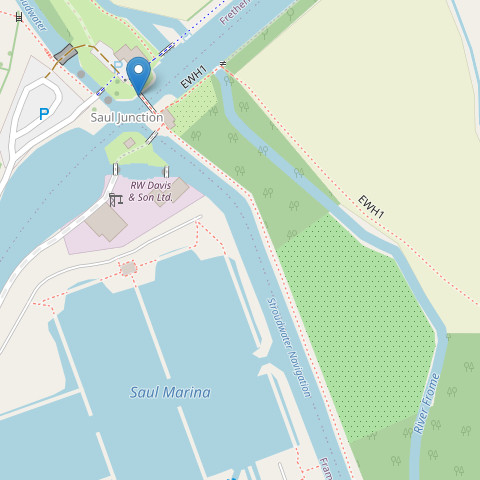
Walking south-east across the footbridge (see pointer on map) there is a right-hand bend and then an opening from the canal to a thriving marina.

The canal itself is very wide at this point and there are many moored boats alongside the towpath, The photo shows the widened Stroudwater Navigation in the foreground and the marina entrance. From here, the towpath continues to Walk Bridge.

Originally built as a swing bridge, Walk Bridge was replaced by a concrete and brick constuction, so a new opening bridge must be constructed to replace it. Cross the road and it’s clear that the canal is still in water at this point, but there’s no towpath. Enter the field by the stile, turn left, and walk diagonally across the field to the far side leaving the canal behind and to your right.
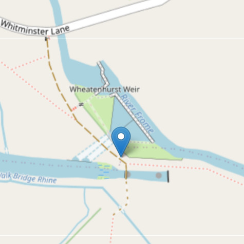
This brings us to Whitminster Bridge and Lock where there’s another glimpse of the canal’s remains. The photo below shows the point marked on the map. Turning a couple of metres right along the farm track will give you a view of the old canal lock. There was another swing bridge at this point.
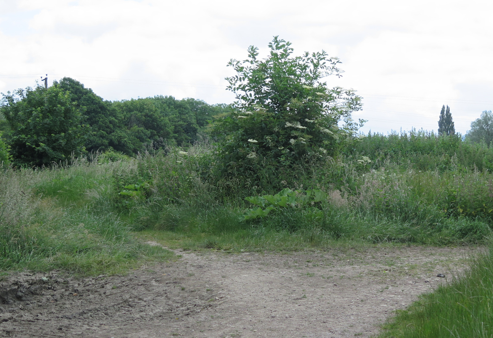
Easy to go wrong here!

The small footpath to the left in the photo is part of the towpath and this is the route to take next. As you follow this path you’ll see the River Frome on your left. The canal has been filled in and would have been on the right.

The path and the river both bend to the right and then the path enters a strip of woodland along the river bank.

Through the wood

The path is poor, with large potholes filled with mud after prolonged rain. Care is needed and there are many roots that form real trip hazards, but the woodland doesn’t continue for very long (250 m or so) so slow and careful won’t reduce progress very much overall.
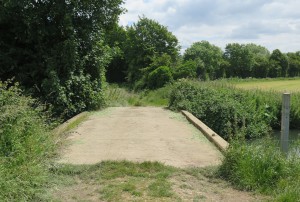
Once again, the river and footpath bend to the right, look for a concrete farm bridge (photo) across the river and take it, you’ll soon have the canal on your right. There was an aqueduct close to this point where the canal crossed over the river, but it no longer exists and the canal has been filled in for a short distance.
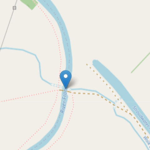
The map marker points to the bridge mentioned above; if you expand the map you can see the end of the woodland at top left and the canal section in water as well as the filled in part.
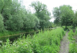
That looks more like a canal now!

The next major feature is a crossroads of tracks and footpaths, there’s a post here with a blue Cotswold Canals sign which you should follow. The canal is in water again at this point, stand on the track where it crosses the canal and you can see it for a long way in both directions. you’ll also have a clear view of the canal as you continue along the towpath (photo). At the time of writing dredging work is underway on some days. If you’re unlucky parts of the towpath will be closed and you’ll be redirected. But most likely it will be open (and is always open at weekends and on summer evenings).

On to the bridge and pillbox

The final section of this walk is quite straightforward – just keep following the towpath. There are some interesting things along the way though, and an unexpected treat at the end as well. On your way you may see evidence of the dredging work still active along this section.
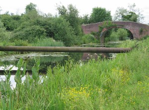
When you come to a stile, cross it into the next field and continue on the towpath. A little further and you’ll notice a large pipe acros the canal and just beyond it a brick-built bridge, this is ‘Occupation Bridge’. The pipeline was constructed during World War II, part of a network to carry aviation fuel for the RAF. It is still in use and will need to be diverted beneath the canal.
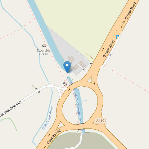
Beyond the bridge you’ll find a pillbox (also WW II) near the right bank of the waterway, and shortly afterwards you’ll arrive at the destination for this article, the A38 roundabout. Here comes the unexpected treat I mentioned earlier. Make your way through the galvanised steel gate and turn left, a short downhill scramble. Here you can pick up the towpath again and explore a newly built section of canal crossing the centre of the roundabout. So astonishing to see a newly built canal in the middle of a major intersection!

The canal here was built by National Highways who also constructed the roundabout. When you reach the far side you’ll see that the canal currently ends at this point. The ‘Missing Mile’ begins here and we’ll explore it in the next article, ‘Canal Walk 3’.

See also:

*This is a great source of canal images, history and all sorts of detail. Highly recommended and well worth exploring!

< Previous | Index | Next >

Useful? Interesting?

If you enjoyed this or found it useful, please like, comment, and share below. (If you don’t see those links, click the article’s title above the main photo and they will appear.) Send a link to friends who might enjoy the article or benefit from it – Thanks! My material is free to reuse (see conditions), but a coffee is always welcome and encourages me to write more often!

Canal walk 1 – Severn to Saul Junction

Severn trows were flat-bottomed, single masted sailing vessels, and the Stroudwater canal was wide and deep enough to take them.

< Previous | Index | Next >

This section of Stroudwater Navigation is not being restored, but it is certainly of historical interest and mostly remains visible on the ground. It’s still possible to walk almost all of the towpath and not too hard to imagine what it might have been like when it was in use.

The connection to the River Severn
The River Severn at Framilode (near high tide)

The physical point where the canal joined the Severn is not accessible as it’s on private land. However, it’s easy to get very close. The River Severn is still tidal at this point, and the canal engineers had to take this into account. Instead of a single lock gate providing access, there were several; this allowed boats to transfer between river and canal for longer periods as the tide ebbed and flowed.

To find this spot on the ground, visit the village of Upper Framilode and look for the point near Lock House where the road crosses the line of the canal, then click the tiny map on the right for a larger, draggable and scalable version. The pointer shows where the canal and river meet, the place where Severn trows and other boats would have entered the canal heading towards Stroud, or exited into the Severn to make their way north towards Gloucester, Hereford and Worcester, or south towards Bristol and the River Wye to Chepstow and Monmouth. If you have time, pop into St Peter’s church in the village and enjoy the simple stained glass and the beautifully painted ceiling. A peaceful place, used by the local community in many interesting ways.

Severn trows were flat-bottomed, single masted sailing vessels, and Stroudwater Navigation was wide and deep enough to take them, with locks sized accordingly.

You can also view a map of the canal from the 1840s to compare with the current map. This, too, is draggable and scalable. If you open two browser windows side-by-side with the modern map in one and the historical map in the other, it’s fascinating to see the many changes that have taken place.

To start the walk south from Upper Framilode, look for the footpath just left of the canal as seen from Canal Row. This is the old towpath and runs between the canal and the row of buildings that grew up along the first 100 m of the canal. Presumably most, if not all, of these buildings sold necessities to the passing canal traffic. I can imagine everything from ale to fresh well water and hens eggs and other garden produce being traded while boats loaded and unloaded or just waited for a lock to fill or empty.

Heading south
View back to Canal Row – from left are the canal, grassy towpath, and row of buildings

The first landmark you will come across is ‘The Ship’ inn. You’ll pass the pub and then its car park, both on the left. After passing it, looking back you’ll see its name painted on the building’s wall. It’s only 250 m or so from the start of the walk.

It’s not hard to imagine the trows travelling to and fro along this section of the canal. No doubt the pub was a popular stop.

The Ship Inn, looking back towards the start

As you can see, this first section of canal is still in water, and along the way you will have noticed the large stones edging the canal. Lock gates and other wooden structures have long since gone, of course, rotted away by the action of rain, fungi and bacteria. Like all human technology, canals must be maintained if they are to continue working. Although there’s still water at this point the canal is certain to be heavily sited up, and reeds, rushes and other water-tolerant and water-dependent plants have colonised very effectively.

Saul Bridge

The map marks the next point on the journey, the place where Moor Street crosses the canal over Saul Bridge. It’s the first bridge you come to and is not far beyond The Ship Inn. Originally this was a swing bridge, but the modern replacement is concrete and brick. Continue along the towpath beyond the bridge and you quickly come to the end of the section of canal remaining in water. The scene changes quite a bit from here on.

The River Frome comes alongside the tow path on the left at a point where the canal (still on the right) becomes dry; you can see this point on the map in the previous section. Don’t be confused! For a while you will see the Frome on the left of the tow path and the dry canal on the right. In places the canal has been filled in and that makes things even more difficult to visualise. Sometimes you can spot the left bank of the canal as a curved ridge, even when it runs through an open, grassy field. The towpath would probably have run along the flat top of this ridge.

River, footpath, and the bank of the canal

Just keep walking on the footpath and you’ll be OK. If you see signs for the Thames and Severn Way, Cotswold Canals Trust, or Saul Junction follow them; they will all guide you along this section of the canal. After the section of infilled canal, there’s a very overgrown part, and finally the footpath opens onto Saul Junction itself.

Here, the Stroudwater Navigation (opened in 1779) continues straight across the much larger Gloucester and Sharpness Canal, which opened in 1827, carries much larger vessels, and connects Gloucester Docks with Sharpness. At Sharpness, vessels can continue on the river to and beyond Bristol. Look across the ship canal where you will see Stroudwater Navigation continuing, not only full of water, but still in use. I’ll write about that next section in a future article.

Once the ship canal was open, it made a much better, non-tidal route to Gloucester or Bristol, and that’s why this section of the Stroudwater Navigation languished and fell out of use. The crews of trows coming and going to Stroud simply had no reason to enter the Severn from Saul Junction after 1827.

See also:

< Previous | Index | Next >

*This is a great source of canal images, history and all sorts of detail. Highly recommended and well worth exploring!

Useful? Interesting?

If you enjoyed this or found it useful, please like, comment, and share below. (If you don’t see those links, click the article’s title above the main photo and they will appear.) Send a link to friends who might enjoy the article or benefit from it – Thanks! My material is free to reuse (see conditions), but a coffee is always welcome and encourages me to write more often!
Attic staircase

Perspective changes how we see things generally … Whether you’re considering a person, or an opinion, or solving a practical problem, the way you look at things can change everything.

Donna and I visited William and Jane Morris’ home, Kelmscott Manor, in the little, Oxfordshire village of Kelmscott. They lived here from 1871 until 1896. It was a warm, sunny day and we enjoyed lunch in the garden as well as exploring the house.

The attic staircase

Kelmscott Manor is full of furniture from the Jacobean to Victorian periods, and of course it’s also full of William Morris designs in the form of wallpapers, fabrics, and tapestries. An amazing place and well worth a visit.

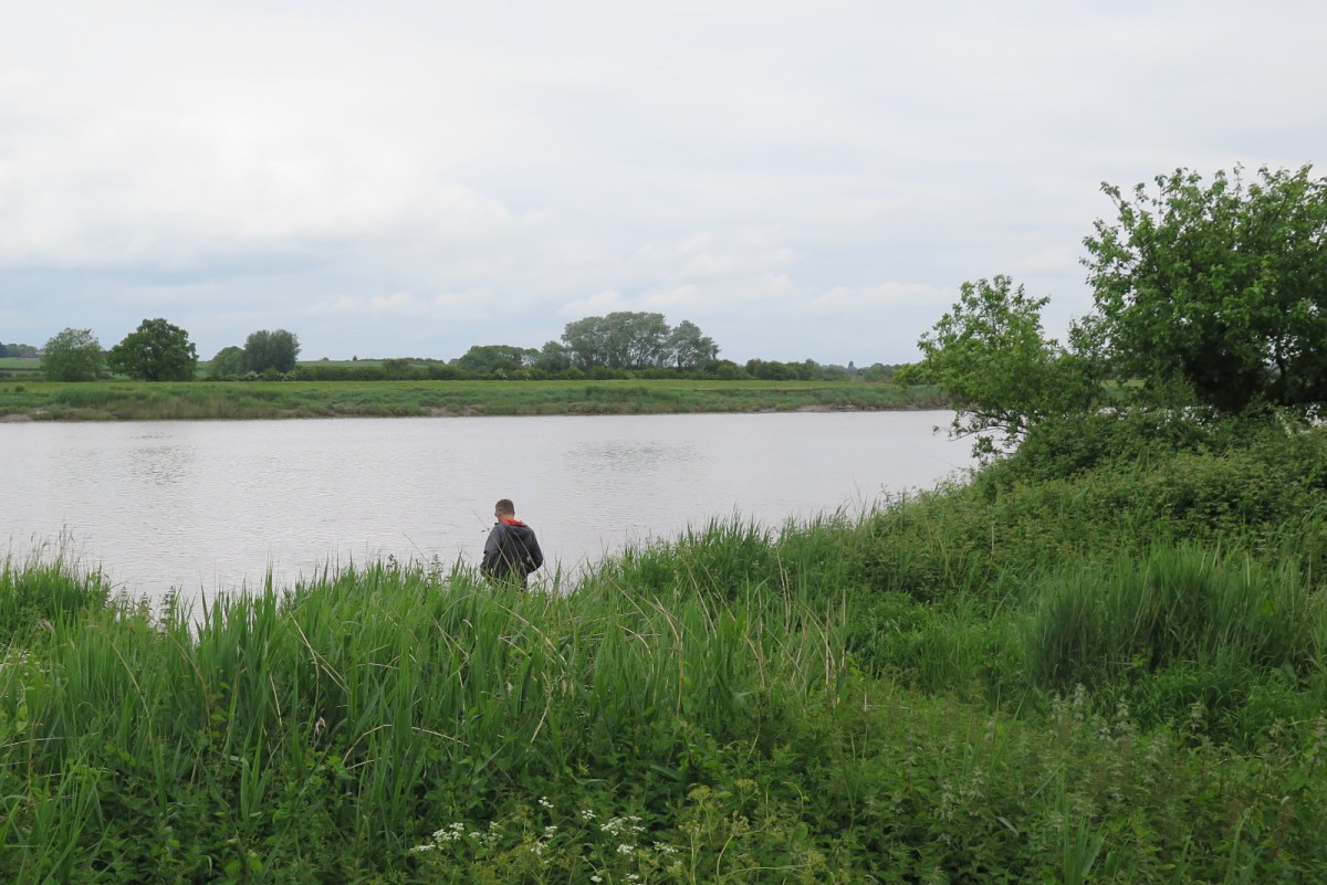
Yet something that stood out for me was this staircase connecting the attic space in the roof with the the lower floors of the house proper. What I like about the photo is the effect of light from the window, and the various textures: the sturdy, wrought iron handrail, which crosses oddly and uncompromisingly in front of the window; the wood of the stair treads; the polished timber of the railing at the top; the mix of reflected colours on what is actually a plain, white wall; and the odd angles created by variations in perspective – it’s quite magical!

Maybe I’ll post again about this lovely old house and its fabulous contents, but for now I’ll leave you with the interesting composition of light playing on an ordinary, day-to-day, attic staircase.

And there’s a life lesson here for us if we think a little deeper. Perspective changes how we see things generally, not just staircases. Whether you’re considering a person, or an opinion, or solving a practical problem, the way you look at things can change everything. Maybe you’re better at this than me, but I need to learn to alter my perspective more willingly when necessary.

See also:

A coffee is always welcome!

Burrito Mama

If you live in or near Cirencester, or are visiting, I recommend this little gem of a place.

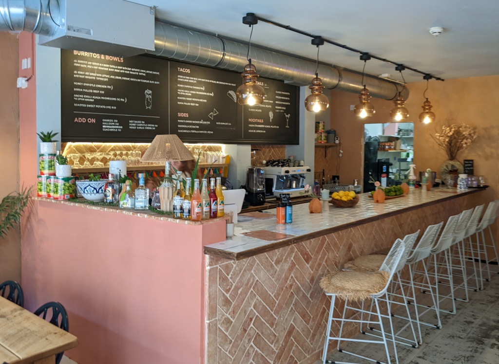
A new food outlet opened recently in Cirencester; we hadn’t had a chance to try it – until now. Burrito Mama is small, but very, very good.

Donna and I popped in at lunch time today to see what it was like. What we found was friendly, prompt service, lovely Mexicanesque decor, good coffee, tables inside and out, and an interesting menu. And when the food arrived it was nicely served and absolutely delicious. I chose their Ancho chilli asada mushrooms, and Donna went for the Honey chipotle chicken bowl. Both were great.

If you live in or near Cirencester, or are visiting, I recommend this little gem of a place. Check out their website online. Scroll down and take a look around. Book online or just pop in if they have space available. Locals will know where the Swan Yard is, very central, just beyond the west end of the Market Place.

Overall assessment… We’ll be back as soon as we have another opportunity!

Blast from the past… 4

In March 1998, Donna and I were married!

< Previous | Index | Next >

Notes from bygone years – March after March after March

Two years ago

There were no posts in March 2021, but I walked a long section of the old Thames and Severn Canal. The photo shows the towpath on the left and the bed of the canal on the right. The canal is being restored, but it will be a long time before this section can carry barges again.

The old canal and towpath
Five years ago

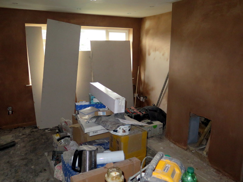
In March 2018 I posted about moving into our new house and adding an extension (‘Our new home in the Cotswolds‘). The building work was disruptive in the extreme, of course. We had to move out for four weeks, and make do with just part of the original space for much longer than that. But it was worth it.

The lounge in chaos
We used to watch TV here!
Ten years ago
Grasshopper landing

In March 2013 I wrote about a TED interview with Elon Musk. Perhaps you haven’t heard of the TED talks, but everybody has heard of Elon. The post is interesting: Musk was already experimentally landing rockets ten years ago, and TED continues to be a great ideas platform. Take a look and explore the links in the original post.

Fifteen years ago

I reported on a meeting at home in March 2008.

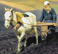
Rachael also shared a picture of an old-fashioned plough making furrows. The soil needs to be churned up and overturned before something new can be grown. There is a necessary process of breaking before the land can be used.

We thought about how Father releases us from ourselves. At the beginning he said, ‘Let there be light’; he still speaks those words into his people today and pours light into the darkest places in our hearts.

Twenty years ago

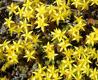
March 2003, another early blog post about a meeting at home. This time there were only two of us, but we heard such a lot! For example, that the tiny stonecrop, the great cedar, and the mighty oak tree were all planted by Father’s hand. The important thing is not to be big or strong, but to be planted by the master.

Twenty-five years ago

And in March 1998, Donna and I were married!

< Previous | Index | Next >